公開日 2021.02.03
更新日 2021.02.05
In order to prepare for The Great Nankai Trough Earthquake and other large-scale disasters, you should research in advance to find out where emergency evacuation areas and evacuation shelters are located.
If you use the comprehensive map system provided by Tokushima Prefecture, you can locate where nearby emergency evacuation areas, evacuation shelters, and welfare evacuation shelters are.
Step1
Click the link below.
Link: https://maps.pref.tokushima.lg.jp/hinansyotou/
**For those accessing the website from their phone/tablet, you may need to switch to desktop mode in order for the website to work properly.
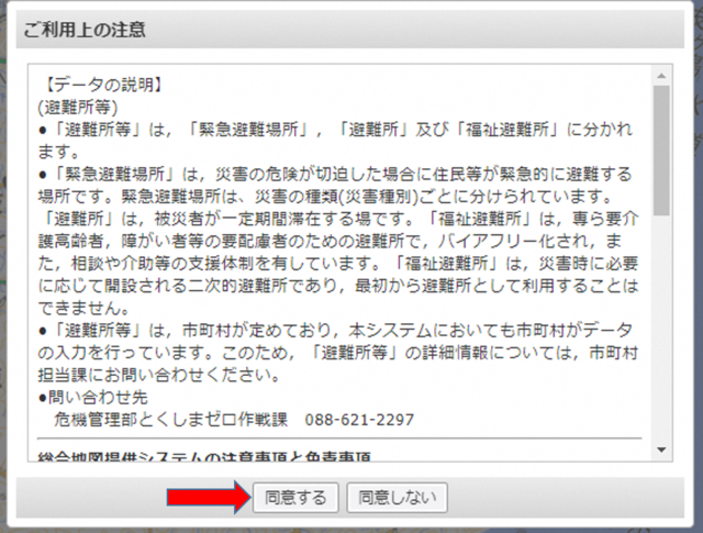
Next, click 同意する to agree to the terms of agreement.
STEP2
Now you’re going to want to put in your location.
Click the 現在地 (current location) button with the blue circle next to it.
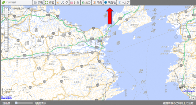
You will then be taken to a screen like this, with the blue dot indicating your location.
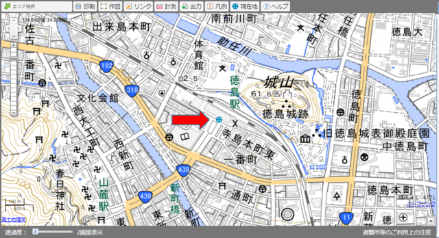
**Tip: For those more accustomed to Google Maps, on the right side of your screen you can select the グーグルマップ (Google Maps) option to change the display.
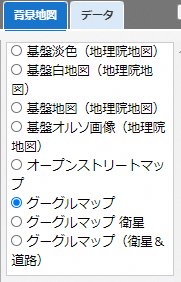
Your display will now look like this.
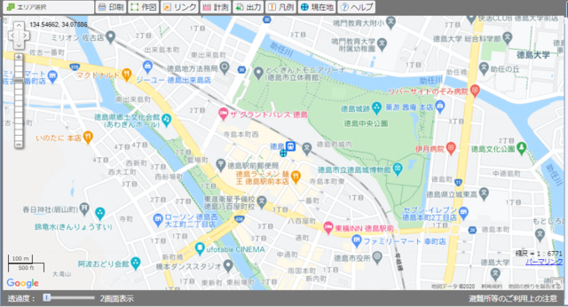
If for some reason the “現在地 current location” button doesn’t work or did not display the correct location, you can also input your area manually.
On the left side of your screen, you will see a box that looks like this. You will want to click the light blue 地名検索 tab.
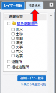
You will then be taken to a screen where you can type in your location down to the “cho” (町) level. The website will only recognize Japanese written in kanji/hiragana, and will not show results for romaji or English. You may have to use Google to find the Japanese spelling of your location. After typing in your location, click 送信.
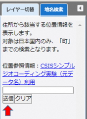
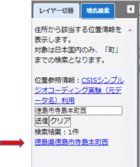
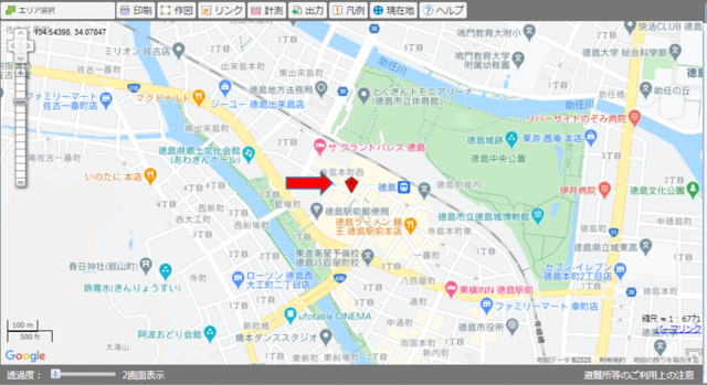
For our example, we will be using the JR Tokushima Station. It is located in Tokushima City, Terashimahonchonishi. In kanji this would be written as 徳島市寺島本町西. Once we type that in, we will get some search results. Click the correct location and you will be taken to a screen similar to the one above, but with a red location mark instead.
STEP3
Now we are ready to look for nearby evacuation shelters. On the left side of your screen, you will want to click the tab called レイヤー切替.
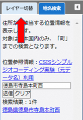
You will then be given a variety of options you can select. Below is a translation and brief explanation of the different types of areas you can search for.
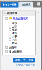
緊急避難場所(きんきゅうひなんばしょ) (Kinkyu Hinan Basho) Emergency Evacuation Area

Areas where you can evacuate to in times of emergency in order to protect your life. Separated based on disaster category. (See Below)
- 洪水(こうずい) (Kouzui) Flooding
- 土砂(どしゃ) (Dosha) Landslides
- 高潮(たかしお) (Takashio) Storm Surges
- 津波(つなみ) (Tsunami) Tsunamis
- 火事(かじ) (Kaji) Fires
- 内水(ないすい) (Naisui) Inland Flooding
- 地震(じしん) (Jishin) Earthquakes
避難所(ひなんじょ) (Hinanjo) Evacuation Shelter

Locations where you can evacuate to until the danger of the disaster has subsided. Those who have lost their homes can stay here temporarily.
福祉避難所(ふくしひなんじょ) (Fukushi Hinanjo) Welfare Evacuation Shelter

Special evacuation shelters that are set up to aid the elderly, disabled, sick, etc.
If you want to search for an evacuation shelter, then you would click the 避難所 box. Any nearby evacuation shelters will then appear on the map with this mark:

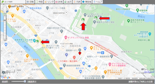
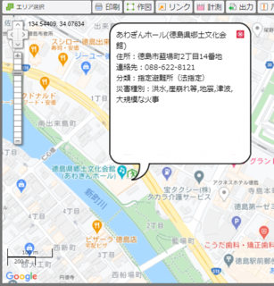
You can click on any of the  marks to bring up more information.
The information is only available in Japanese, so you may have to use Google to search for the English name and address. If we look up this location, we find it is Awagin Hall (Tokushima Arts Foundation for Culture).
You can use the same process to find a nearby emergency evacuation area or welfare evacuation shelter.
**Disclaimer: Information may change or may not be up to date. Thank you for your understanding.
